Mount McLoughlin
Part of the Cascade Range, Mount McLoughlin is the highest peak in Southern Oregon. A dormant volcano, Mount McLoughlin is a classic cone- shaped stratovolcano whose last eruption was about 30,000 years ago.
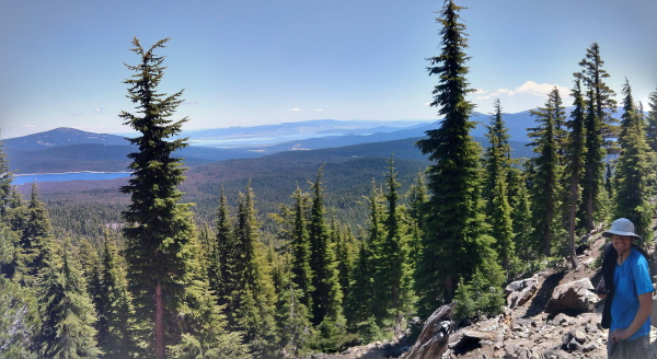
 Views from Below the Treeline of Mount McLoughlin, OR
Standing at just under 9500 feet elevation, Mount McLoughlin is a lava cone with very steep sides. Much of the sides of the mountain are covered with large boulders of past landslides. Even parts with vegetation show evidence of boulders of past landslides.
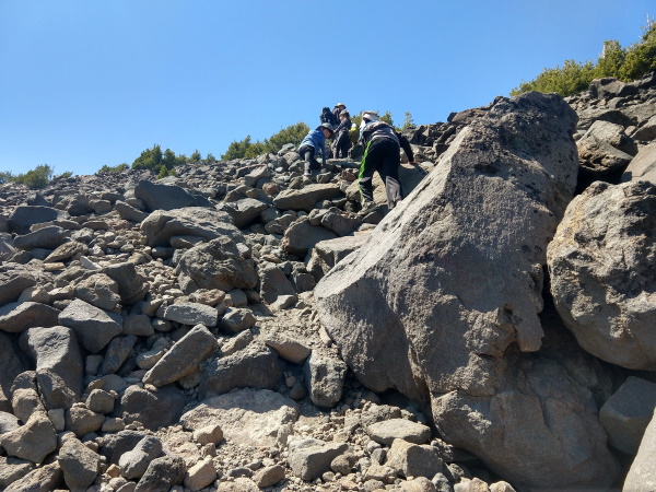
At around 10 miles round-trip, with almost 4000 foot elevation gain, Mount McLoughlin is probably the toughest hike I have done. The start of the hike had a disrepaired bridge which we managed to negotiate ourselves over (your discretion for safety required here). The ascending trail afterwards was smooth sailing with amazing aerial views of several blue bodies of water. That kept us distracted for the first part of the hike. Near the treeline, the trail gets a little more challenging with large cut boulders as steps. Beyond the treeline, the trail somewhat disappears and becomes loose gravel rock, which then picks up in elevation so it was more of a scramble. With no markers and a lot of false trails, it was not easy to discern the best way up. I made it to the false summit, tried to push on further but the bouldering got the best of me.
 Scrambling up Mount McLoughlin, OR
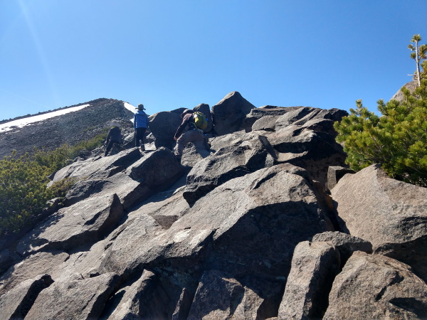
My husband and two sons pressed on to the summit while I waited for them near the false summit.
 My turn around point, Mount McLoughlin, OR
Because the trail was hard to find, my husband found himself going down a completely different route than he went up, which did not take him close to us at all. We texted back and forth (thank goodness for data near mountaintops), trying to figure out the other's location. When I had determined that he had gone down below where we were, my oldest son and I decided to make our way down. There was a very nervous period of half an hour or so where we did not know if we would meet up with the rest of the family again on this mountain. Fortunately for my oldest son and I, we had the backpack which carried our emergency 2-person tent and extra jackets. Not so fortunate for my husband and my two other sons, they only had the first aid kit. Given that overnight temperatures on the mountain would dip below freezing, I was very concerned for the rest of my family.
Luckily, between our yelling voices and the winds blowing in the right direction, we found each other. There was a mini celebration but then it was time to continue going down the mountain before we lost precious daylight. It seemed simple enough on our way up; it seemed like there was only one way up, therefore the way down should be easy to figure out, so we thought. The rock scrambles seem just as hard going down as they did going up. It seemed like it went on for a long time. Remembering the warning signs down below to keep the lakes to our left and to head east, we headed in the opposite direction of the setting sun. As if the rock scrambles were not enough of a challenge, the small loose rocks have now turned into fields of huge boulders with jagged rocks and crevices between them.
Before we knew it, we had gone below the treeline with no trail in sight. Still headed in the opposite direction of the setting sun, we pressed on, now with my handy Google offline maps in hand, which told us where our car was parked (since I had to enter the coordinates to drive to the trailhead) and better still where the Pacific Crest Trail was. Not all trails are on Google Maps so this was a lucky break. Unfortunately, my cell phone battery was running low, and I had forgotten the connecting wire to charge it to the portable charging battery we carry.
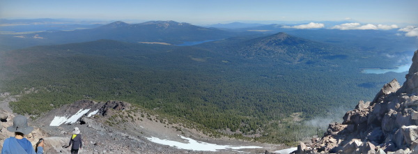
 Views from the summit of Mount McLoughlin, OR
After our third boulder field crossing when dusk started creeping in, I started thinking that it was very possible that we would have to spend the night in the wilderness on the slopes of Mount McLoughlin. Below freezing overnight temperatures and the pack of wolves that inhabit these areas did not give me much comfort. But the emergency 2-person tent, matches, mylar blankets and extra jackets we carry in our packs did give me some hope that we might make it through the night. We were, at least, together, so we all had access to all of our emergency supplies.
Another three or four boulder field crossings later, we finally got to a trail of some sort. Google Offline maps had successfully led us to an unmarked trail. Never have we been so happy to see a trail! There was a time when a trail marked the start of nature for me, but now a trail became a mark of civilization. Follow the trail (in the correct direction) and you will get to where you want to go (as long as you take the right trail). We guessed that the trail that we found was the Pacific Crest Trail, but about 15 minutes of descending the mountain told us that we were mistaken. It was the trail that we were on earlier in the day on our ascend up the mountain. The 15 minute hike got us to the intersection with the PCT and another 15 minutes got us to the parking lot, right at 9pm! Emerging safely from the mountain that almost defeated us, never had we felt so alive after a hike!
No pictures of our descent because we were rushing down since we were losing daylight, we were in panic mode and the battery on our cells were running low. It always amazes me though, how well we manage as a team when the going gets tough. All complaining disappear, boys take on packs when the other needs a hand and we pull through (so far anyway.) If I were to do it over again, I would pay more attention to the warning sign at the parking lot though I'm not sure if we could have prevented getting lost given the number of false trails. I would highly recommend taking enough layers, emergency shelter and supplies to spend the night if necessary. Definitely bring a flashlight and a GPS device that allows you to backtrack. We had forgotten to bring our Garmin watch, which I'm sure would have helped track our way back to the trail. I think we're also considering investing in a mapping app that provides trail and topographical information.
Unfortunately that night was the night we had to switch campsites, so getting back to our campground at 10pm with a tent to pitch in the dark was less than ideal. But we were all very grateful to be in the embrace of our warm sleeping bags at temperatures 20F higher than the mountain's slopes. The next day we had planned to go to Sky Lakes Wilderness again (the same wilderness as Mount McLoughlin), but decided to give the boys (and ourselves) a break by enjoying a tourist day at Crater Lake.
| Features: | Views of several blue lakes from above as you ascend rugged stratovolcano Mount McLoughlin. |
|---|---|
| Our Hike: | About 10 miles rt, 3900 ft elevation gain in forest initially, then rocky scramble above the tree line. On the descent, 7-8 boulder crossings due to an incorrect trail taken. |
| Fees: | $5 per car |
| Website: | For the most updated information, please visit Mount McLoughlin |
More Oregon Travel Ideas More U.S.A. Travel Ideas More Worldwide Travel Ideas
